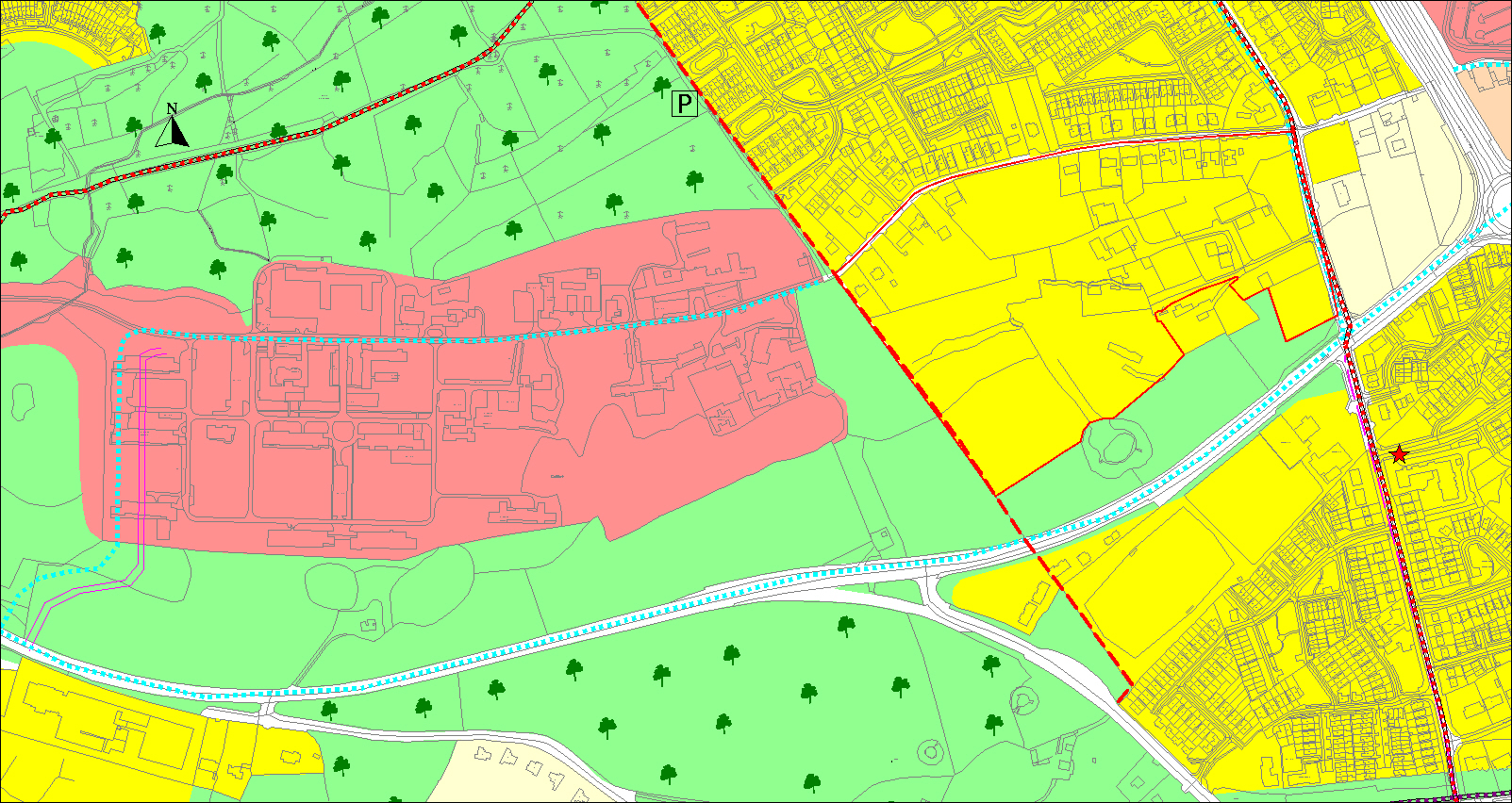
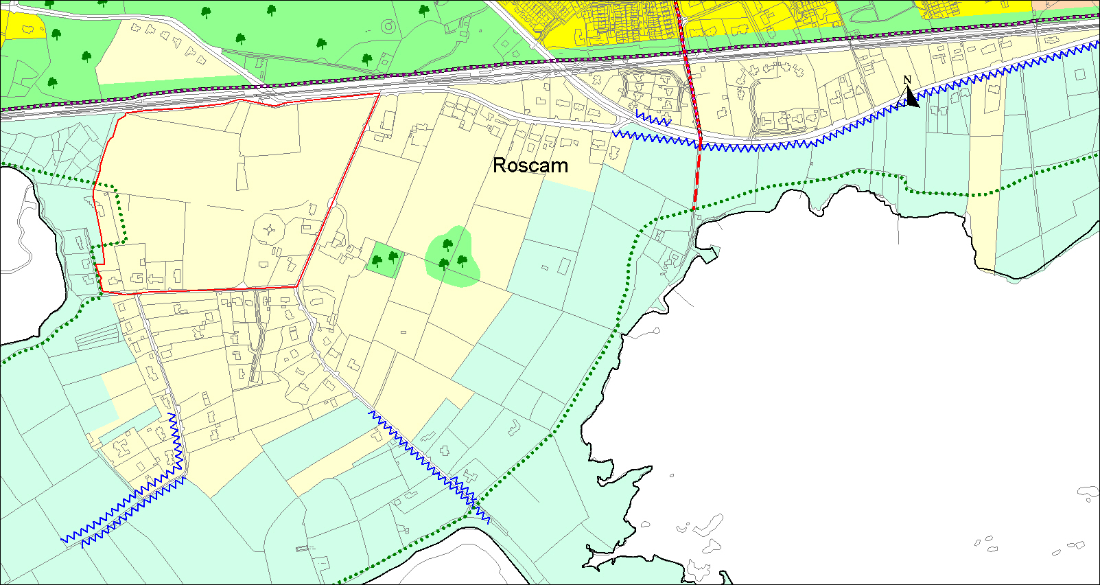
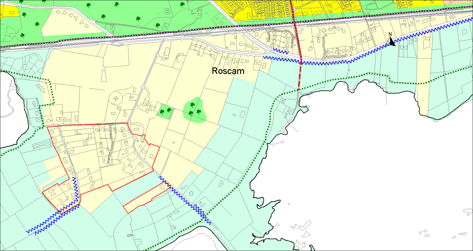

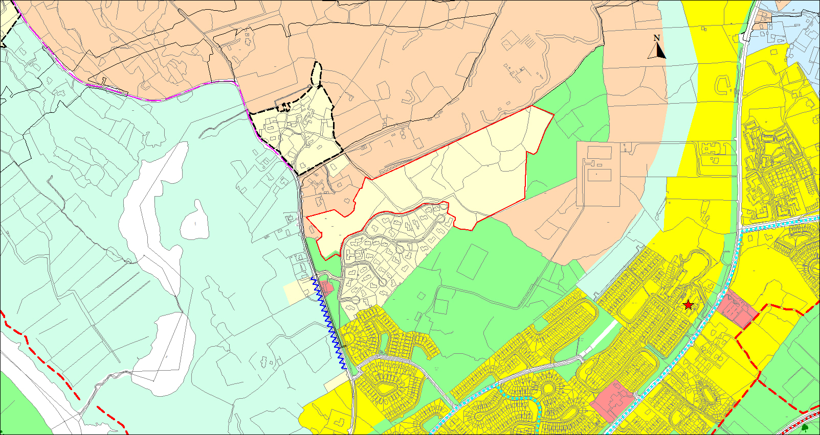

See attached submission respectfully requesting a specific objective to facilitate car parking on land zoned RA at GPT Industrial Estate Tuam Road
Part A - Land Use Zoning Policies and Objectives
Closed28 Feb, 2022, 9:00am - 13 Apr, 2022, 11:59pm
Part A - Land Use Zoning Policies and Objectives
11.2 Land Use Zoning General
The Development Plan sets out the land use zoning objectives for different areas within the city and indicates examples of uses that may or may not be acceptable within each use zone. Zoning seeks to promote the development of uses that achieve the objectives for the area concerned and to prevent the development of incompatible uses. Eleven land use zonings are utilised in the Plan to indicate the various objectives for these areas (Table 11.1).
Table 11.1 - Land Use Zones and Zoning Objectives
|
CF |
To provide for and facilitate the sustainable development of community, cultural and institutional uses and development of infrastructure for the benefit of the citizens of the city. |
|
RA |
To provide for and protect recreational uses, open space, amenity uses, natural heritage and biodiversity. |
|
A |
To provide for the development of agriculture and to protect the rural character. |
|
G |
To provide for the development of agriculture and protect areas of visual importance and/or areas of high amenity. |
|
I |
To provide for enterprise, industry and related uses. |
|
CI |
To provide for enterprise, light industry and commercial uses other than those reserved to the CC zone. |
|
CC |
To provide for city centre activities and particularly those, which preserve the city centre as the dominant commercial area of the city. |
|
R |
To provide for residential development and for associated support development, which will ensure the protection of existing residential amenity and will contribute to sustainable residential neighbourhoods. |
|
LDR |
To provide for low-density residential development which will ensure the protection of existing residential amenity and environmental sensitivities. |
|
LAP |
Local Area Plan for Murrough. |
|
UVC |
To provide for a residential led mix of uses particularly those that will support a people and business friendly urban village centre and contribute to establishing a high quality sustainable urban form. |
The land use zoning objectives in the chapters of the Development Plan give an indication of the acceptability of new uses in each zone. They are intended as a guideline and are not exhaustive. Under each land use zoning, examples of uses which are compatible with and contribute to the zoning objective are specified. Examples of uses shown as “Uses which may contribute to the zoning objectives, dependent on the location and scale and the proposed development”, are uses which may not be considered acceptable in principle in all parts of the relevant land use zoning objective and will only be accepted where the Council is satisfied that the use would not have an undesirable consequence for prevailing use or amenity. A use that is not compatible or does not contribute to the specific land use zoning objective will not be permitted in that land use zone. Uses not cited as examples of uses but which fulfil the land use objective shall be considered in relation to general policy and to the zoning objectives for the area in question.
Uses, which are temporary in nature, may be considered by the Council as uses that are compatible and contribute to the zoning objective.
In the boundary areas of adjoining zones it is necessary to avoid developments which would be detrimental to the amenities of the more environmentally sensitive zones. For instance, in areas abutting residential zones a particular proposal may not be acceptable which could be acceptable in other parts of the zone. Where a site for a proposed development straddles the boundary of different land use zones the permitted density on the overall site will be an average between the different zones subject to residential amenity.
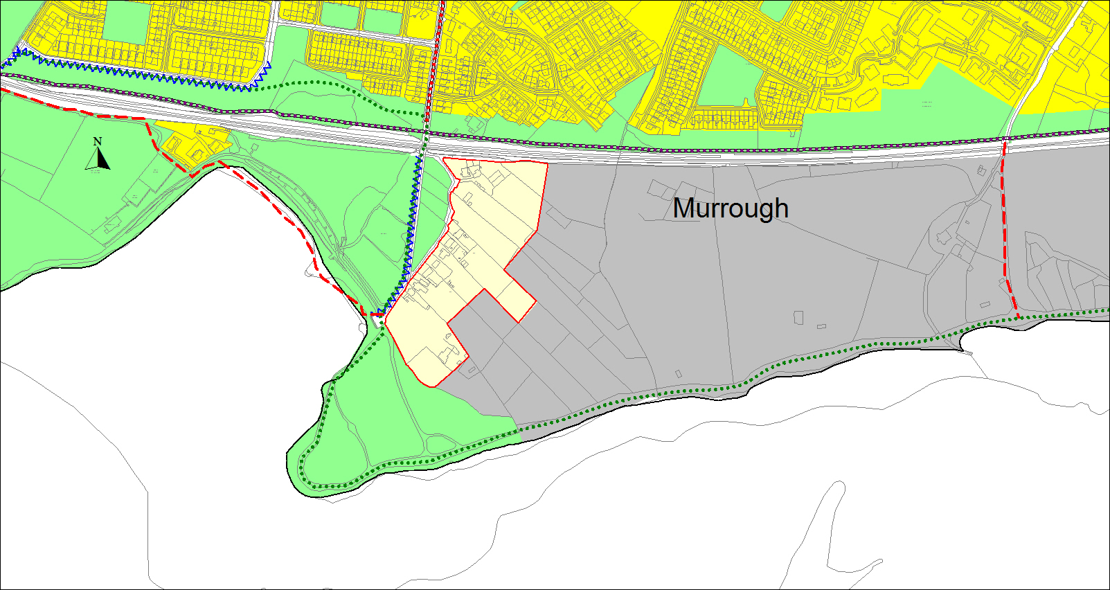
In advance of the adoption of the Local Area Plan (LAP) for Murrough, minor developments in the LAP zoning which will not prejudice the aims of the LAP will be considered. These uses shall be compatible with and contribute to the G zoning objective.
Priority will be given to the reservation of the N6 GCRR designed strategic road corridor and any associated land requirements over other land use zonings and specific objectives.
For clarity, in conjunction with zoning objectives, additional requirements for development on Regeneration and Opportunity Sites are set out in Chapter 10.
11.2.1 Institutional and Community CF Land Use Zoning Objectives
|
Zoning Objective CF To provide for and facilitate the sustainable development of community, cultural and institutional uses and development of infrastructure for the benefit of the citizens of the city. |
|
|
Uses which are compatible with and contribute to the zoning objective, for example: |
|
|
Uses which may contribute to the zoning objectives, dependent on the CF location and scale of proposed development, for example: |
|
The following are specific development objectives for a number of CF zones throughout the city:
- CF lands at Merlin Park comprising approximately 34 hectares. The Council will consider the development of these lands for institutional or community facilities use either by the Health Services Executive or another institution and will not permit residential, commercial or industrial development.
- CF lands south of the Old Dublin Road opposite the GMIT comprising approximately 3.30 hectares. The Council will consider the development of these lands for institutional or community facilities use either by the GMIT or another institution and will not permit residential, commercial or industrial development.
- CF lands at Ballybane to the south of Castlepark Road comprising approximately 6.27 hectares occupied by the Brothers of Charity Services. The Council will consider the development of these lands for institutional, amenity or community facilities use either by the Brothers of Charity Services or another institution and will not permit residential, commercial or industrial development.
- CF lands south of the railway line at Renmore occupied by the Defence Forces comprising approximately 9 hectares. The Council will consider the development of these lands for institutional, amenity or community facilities use either by the Defence Forces or another institution and will not permit residential, commercial or industrial development.
- CF lands at Fisheries Field (Earls Island). These lands will be considered as part of the overall regeneration of Nuns Island Masterplan area.
- CF land at Presentation College, Presentation Road. The design of development shall contribute to the protection and enhancement of adjacent waterways and protected structures on site.
11.2.2 Natural Heritage, Recreation and Amenity RA Land Use Zoning Objectives
|
Zoning Objective RA To provide for and protect recreational uses, open space, amenity uses, natural heritage and biodiversity. |
|
|
Uses which are compatible with and contribute to the zoning objective, for example: |
|
|
Uses which may contribute to the zoning objectives, dependent on the RA location and scale of development, for example: |
|
The following are specific development objectives for a number of RA zones throughout the city:
- RA lands in the areas of Ballybaan and Ballinfoile. The Council will consider regeneration plan(s) which will include for the provision of community services and infill residential developments on existing open space, where it is shown that the open space is deemed surplus and where the recreational requirements and residential amenity are not prejudiced.
- RA lands privately owned by NUI Galway, comprising of 36.98 hectares, but not including the strip of land zoned RA located between the River Corrib and University (CF) lands. The Council will consider the development of these lands for university and related uses, which are compatible with and contribute to the CF zoning objective. An exception to this will be for the Council to allow for consideration of the development of a secondary school with associated ancillary development on lands of approximately1.6 hectares (4 acres) between NUIG Hockey Pitch and the N59 Road. Any development of this site for a secondary school shall include for a School Traffic Control Management Plan and a Mobility Management Plan which will be required to have targets for sustainable mode use, including public transport set targets for modal shift to sustainable modes and public transport for staff and students working at and attending school in accordance with climate action targets.
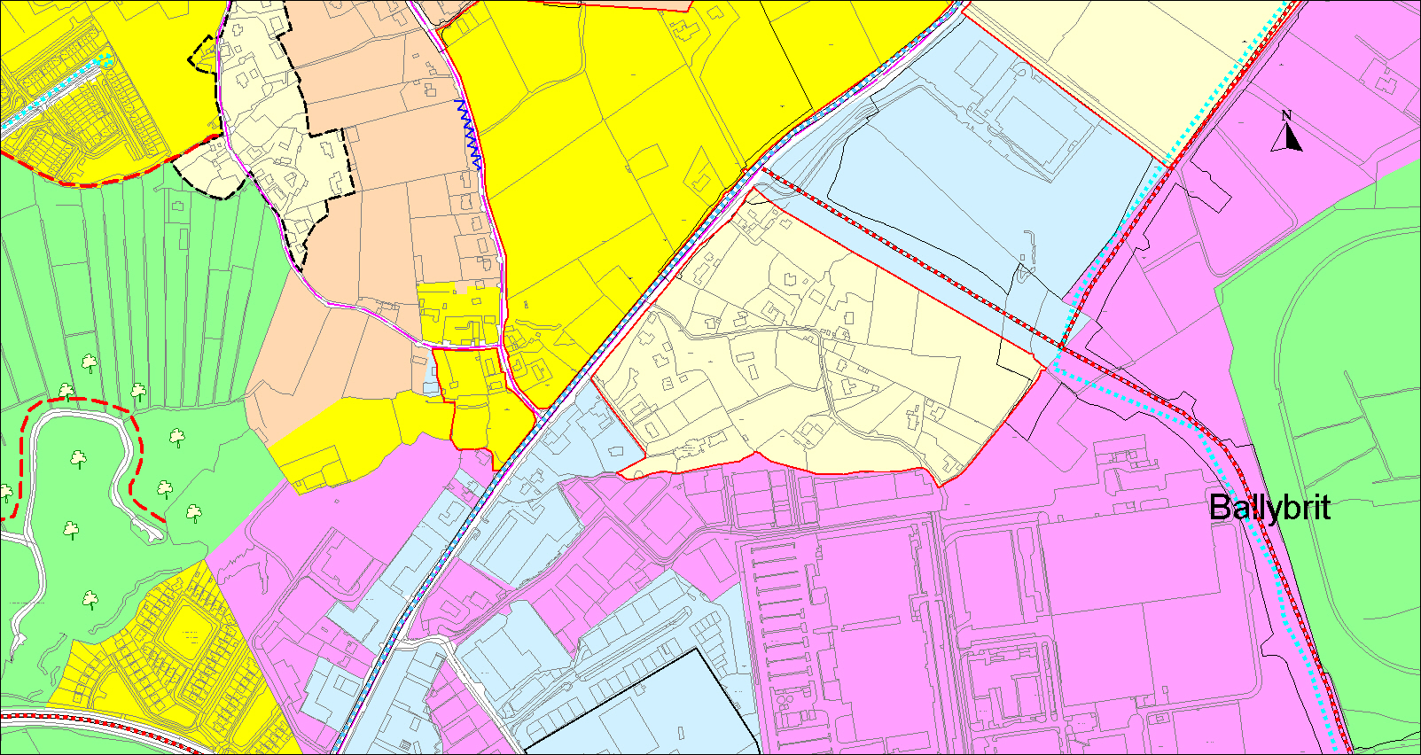
- RA lands located at Ballybrit Racecourse. The Council will consider the use of existing hospitality facilities and racecourse grounds for suitable commercial purposes including conferences, exhibitions, markets, agricultural or similar shows and park and ride facilities.
- RA lands at Doughiska North of Túr Uisce. The Council will consider the development of part of these lands for a swimming pool/leisure centre with concessionary public use and a childcare facility, where a community facility is proposed as part of the development. This development shall not compromise the provision of a pedestrian and cycleway in this area.
- RA lands at NUI Galway in the vicinity of the Quincentenary Bridge. The Council will consider the strategic requirements to link the northern and southern campus. This will be subject to examination of all potential options, transport, visual and environmental considerations and where it can be demonstrated that the preferred option will have sustainable benefits.
- RA lands between the River Corrib and the Dyke Road and south of Quincentenary Bridge Road in Council ownership. The Council will consider the development of these lands to accommodate municipal and club water based facilities. Development of these lands shall include criteria for a high standard of design and shall be subject to environmental assessments in relation to European sites.
- RA lands at Liam Mellows GAA Club Ballyloughane. The provision of structures (including additional pitches, lighting, flood lighting and ball stop nets) to improve the playing pitches, operations and facilities will be considered by the City Council at this location with due regard to the protected views from Hawthorne Drive and environmental impacts.
- RA lands at Cappagh Park. The Council will consider the development of an Aquatic Sports and Fitness Centre adjoining and linked with the existing community centre.
- RA lands at Cappagh Road north of Cappagh Park. The Council will consider use of a portion of these lands to extend the existing car and cycle park facilities at Cappagh Park, with the capacity to operate as a park and ride facility where peak demands for park use do not coincide.
- RA lands located between Circular Road and Hazel Park. The council will examine suitable options to give vehicular access to these lands to facilitate recreation and amenity use.
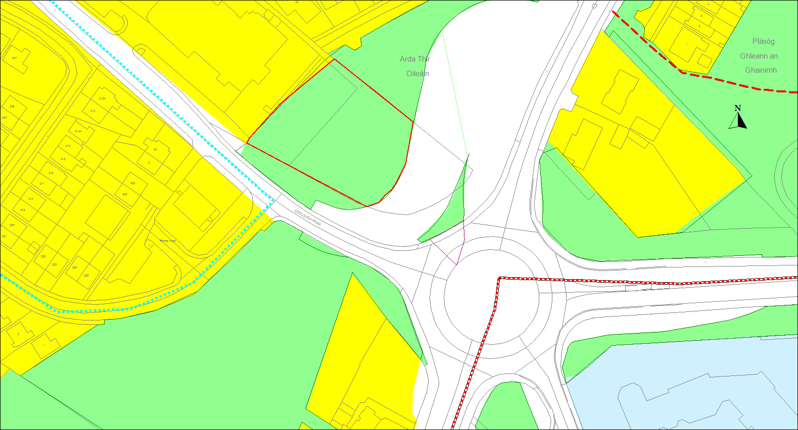
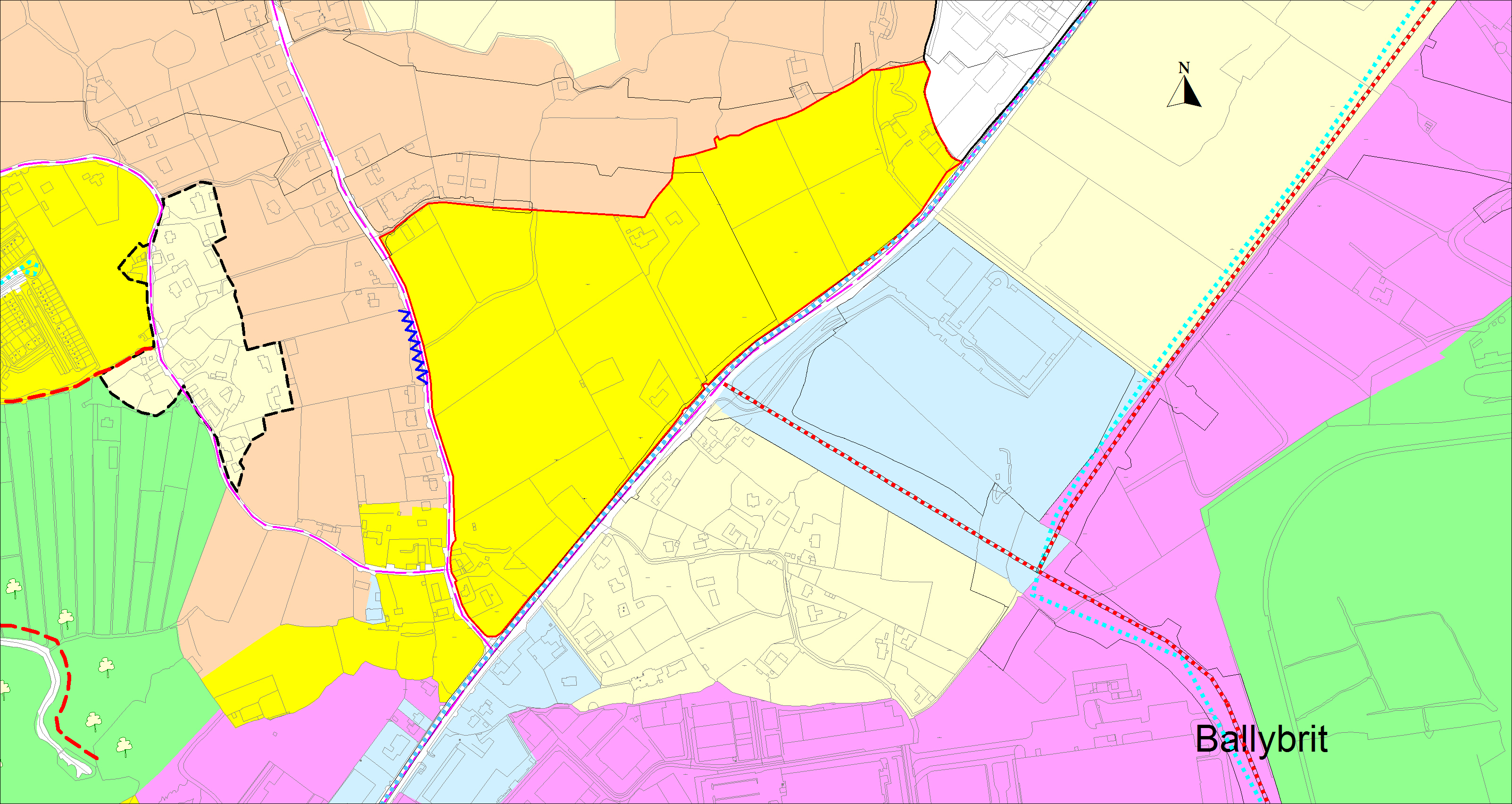
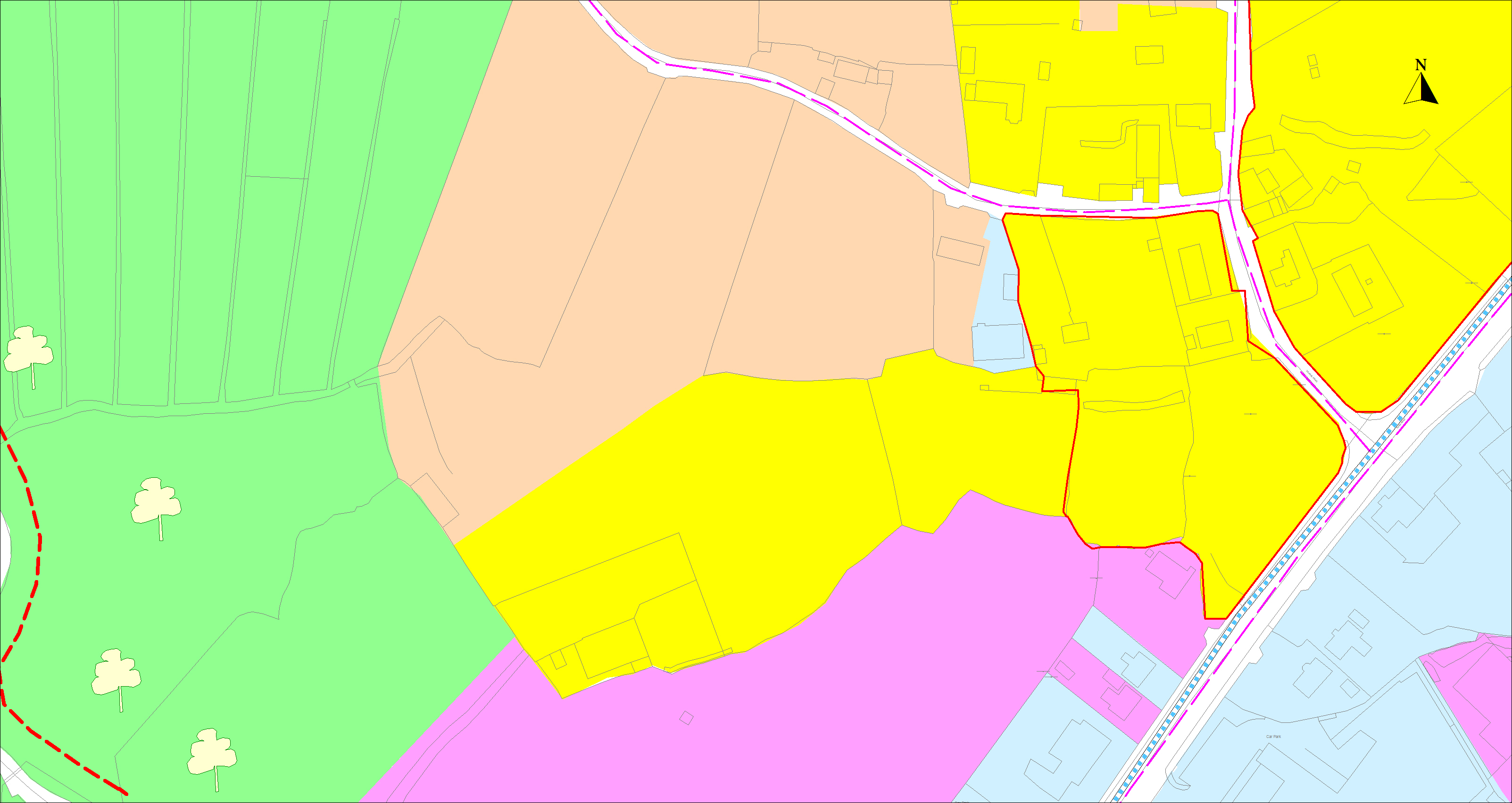
- RA lands located between Ballymoneen Road and Clybaun Road. Maximise access to RA zoned lands located between the Ballymoneen Road and Clybaun Road (see Fig11.7) through connections from the existing road network and through future residential developments.
Figure 11. 1 Menlo Park Hotel
- RA lands in front of the Menlo Park Hotel adjacent to the Kirwan Roundabout. The Council will consider the development of a leisure centre and swimming pool, both located underground with minimal effect overground, as part of the overall hotel development.
Figure 11. 2 Site at Lough Atalia
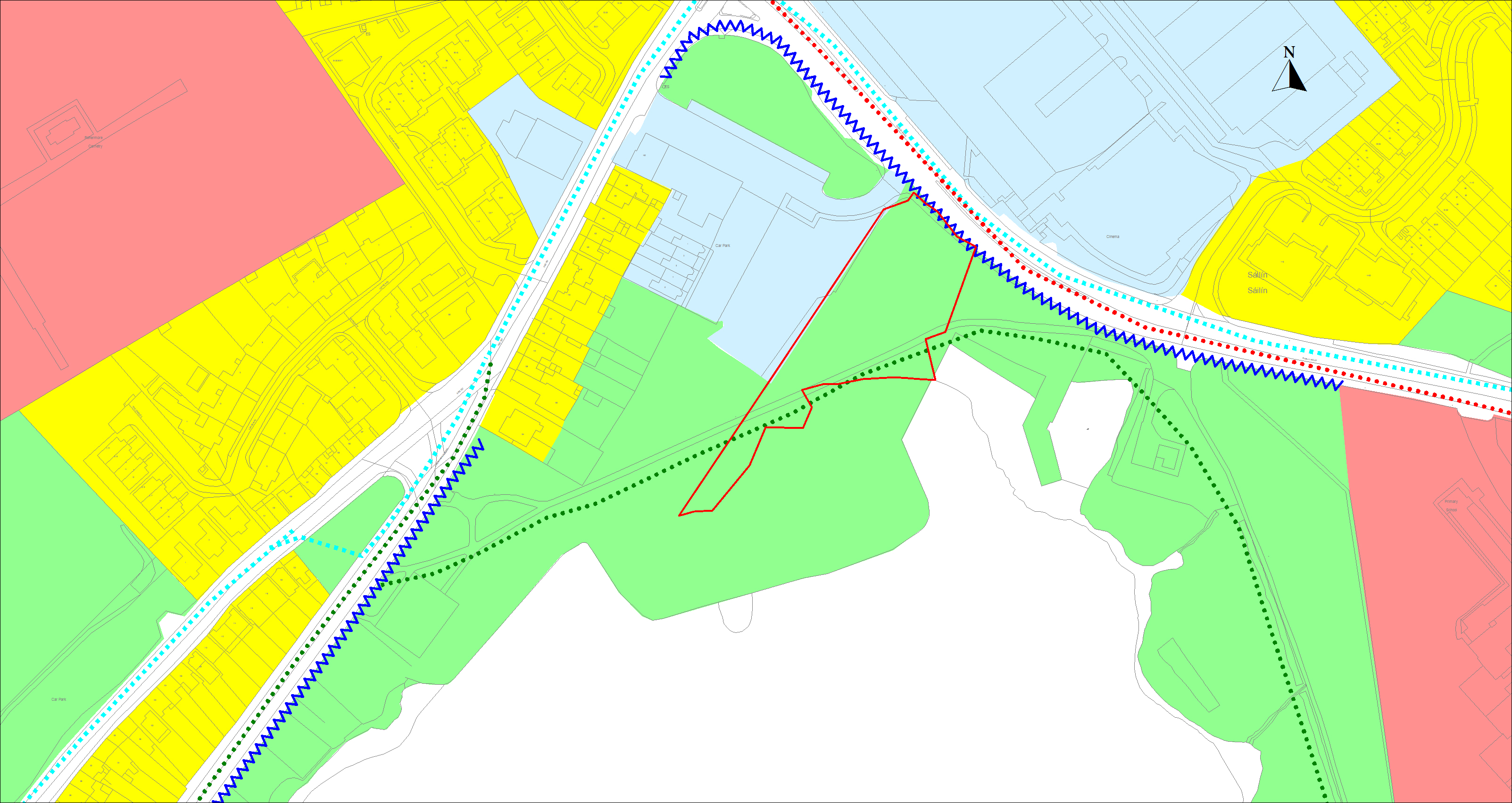
- RA zoned lands at Lough Atalia (0.5 hectares). The Council will consider the development of these lands for sports facilities and an amphitheatre.
11.2.3 Agricultural Areas A Land Use Zoning Objectives
|
Zoning Objective A To provide for the development of agriculture and to protect the rural character. |
|
|
Uses which are compatible with and contribute to the zoning objective, for example: |
|
|
Uses which may contribute to the zoning objectives, dependent on the A location and scale of development, for example: |
|
The following are specific development objectives for a number of A zones throughout the city:
- A zoned lands located to the north of the Martin Roundabout and south of the Galway Clinic, consisting of 0.73 hectares. The Council will consider the use of these lands for commercial residential purposes which can be demonstrated to be directly linked to the services provided at the Galway Clinic, but shall not include services of a medical nature. Use of these lands can include for services of a step-down nature.
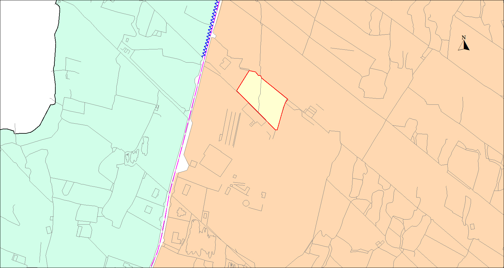
- A zoned land located to the north and adjoining the Menlo village envelope consisting of 0.42 hectares. Any residential development shall be limited to one house only for uses as set out in Section 5.9 Agricultural Lands.
11.2.4 Agricultural Areas G Land Use Zoning Objective
|
Zoning Objective G To provide for the development of agriculture and protect areas of visual importance and/or high amenity |
|
|
Uses which are compatible with and contribute to the zoning objective, for example: |
|
|
Uses which may contribute to the zoning objectives, dependent on the G location and scale of development, for example: |
|
11.2.5 Industrial I Land Use Zoning Objective
|
Zoning Objective I To provide for Enterprise, Industrial and related uses. |
|
|
Uses which are compatible with and contribute to the zoning objective, for example: |
|
|
Uses which may contribute to the zoning objectives, dependent on the I location and scale of development, for example: |
|
The following are specific development objectives for a number of I zones throughout the city:
- Lands zoned I at Rahoon, comprising approximately 29 hectares, the Council will consider the development of these lands for a technology/business park. Development proposals in line with this objective must achieve a parkland setting compatible with the residential amenity of existing and future adjoining housing areas.
- Lands zoned I at Lough Atalia between the railway line and the seashore comprising of approximately 16.2 hectares. Development on this site will be limited to activities relating to Galway Port expansion and industries which must be located adjacent to the harbour for a viable existence, provided however, that the processes involved are environmentally acceptable and do not interfere with the residential amenity of nearby housing developments.
- Lands zoned I at Ballybrit Business Park (north of the N6 dual carriageway, blocks 1-7) and at Rahoon. On these lands within existing constructed office space (completed pre-2004) change of use to general office space that is non-technology or processing based office use, will be open to consideration subject to the following:
- Where such office space will not be dedicated to grouped professional practices/services.
- Where it can be demonstrated that there is adequate car parking spaces provided for such office use that is one space per 50m² of gross floor area.
11.2.6 Commercial/Industrial CI Land Use Zoning Objective
|
Zoning Objective CI To provide for enterprise, light industry and commercial uses other than those reserved to the CC zone |
|
|
Uses which are compatible with and contribute to the zoning objective, for example |
|
|
Uses which may contribute to the zoning objectives, dependent on the CI location and scale of development, for example: |
|
The following are specific development objectives for a number of CI zones throughout the city:
- Bulky goods retailing and local retailing needs, will be the only retail types considered on CI zoned lands not provided for in the Retail Hierarchy at/adjoining; Briarhill, Doughiska Road (West of), Tuam Road, Dublin Road, Sean Mulvoy Road, Sandy Road, Headford Road/Bóthar na dTreabh (north of the Bodkin junction), and Seamus Quirke Road. An exception for the consideration of food store and restaurant use will apply to a portion of CI lands at Briarhill, namely the site of Western Motors and the adjoining site to the east, bounded by the Monivea Road and Parkmore Road.
- Retail development of a nature appropriate to the city centre will be considered on the Headford Road (south of the Bodkin junction). An arts/cultural facility shall be delivered in conjunction with any major re/development of these lands. It is intended to carry out a Local Area Plan as specified in Chapter 10 for these lands termed the Headford Road LAP.
- CI zoned lands on the Headford Road (south of the Bodkin junction), Sean Mulvoy Road, Tuam Road (south of Bóthar na dTreabh), Moneenageisha Road and lands abutting Seamus Quirke Road. Offices appropriate to the CC zoning will be open for consideration on these lands.
- CI zoned lands on Monivea Road (Radharc na Greine site). Residential development on the full extent of this CI zoned site will be considered. The density of any residential development on this site will have regard to the surrounding context.
- CI lands at Wellpark Road adjacent to the Mervue Business and Technology Park. A residential content of up to 75% will be considered on these lands.
- CI lands at Barna Road (fuel-filling station). The current setback of the building, excluding forecourt, shall be maintained.
- CI lands at ‘Joyce’s Supermarket’, Kingston Road, Knocknacarra. The part of the building complex in use as community rooms shall continue to be reserved for community purposes such as uses to facilitate club meetings / recreational classes / community group activities.
- CI lands at Wellpark. The Council will consider the full range of retail uses identified in the Retail Planning Guidelines within Wellpark Retail and Leisure Park.
- CI lands at Sandy Road. Land shall be reserved for a strategic link road from Sean Mulvoy Road to Sandy Road. The location and alignment of this road shall be based on optimum transport and sustainable planning and development considerations.
11.2.7 City Centre Land Use Zoning Objectives
|
Zoning Objective CC To provide for city centre activities and particularly those, which preserve the city, centre as the dominant commercial area of the city |
|
|
Uses which are compatible with and contribute to the zoning objective, for example |
|
|
Uses which may contribute to the zoning objectives, dependent on the CC location and scale of development, for example: |
|
The following is a specific development objective:
- CC land at 6, 8, 10, 12 and 14 St. Augustine Street. Any required development on these sites to facilitate change of use shall not materially alter the elevation of the existing buildings or interfere with the integrity of the terrace.
11.2.8 Residential R and Low Density Residential LDR Land Use Zoning Objectives
|
Zoning Objective R To provide for residential development and for associated support development, which will ensure the protection of existing residential amenity and will contribute to sustainable residential neighbourhoods. Zoning Objective LDR To provide for low-density residential development which will ensure the protection of existing residential amenity and environmental sensitivities. |
|
|
Uses which are compatible with and contribute to the zoning objective, for example |
|
|
Uses which may contribute to the zoning objectives, dependent on the R and LDR location and scale of development, for example: |
|
The following are specific development objectives for a number of R zones throughout the city:
- Undeveloped R zoned lands at Doughiska adjoining the dual carriageway shall incorporate the provision of an 18 metres wide strip of landscaped open space abutting this road.
- The development of residential zoned lands in Council ownership adjacent to the school site at Ballyburke will include for the provision of an appropriate level of community facilities which can include for educational use, to serve the area.
- R zoned lands in the areas of Ballybaan and Ballinfoile. The Council will consider regeneration plans for community services and infill residential developments on existing open space, where it is shown that the open space is deemed surplus and where the recreation requirements and residential amenity are not prejudiced.
- Provide for additional local centres to facilitate local convenience shopping and services. These facilities will be accommodated at Clybaun, Ballymoneen and Ballyburke as indicated on Development Plan maps.
- R zoned lands at Nun’s Island Street (St. Joseph’s school site). The design of residential development shall have regard to the streetscape context and shall also contribute to the protection and enhancement of the adjacent waterways.
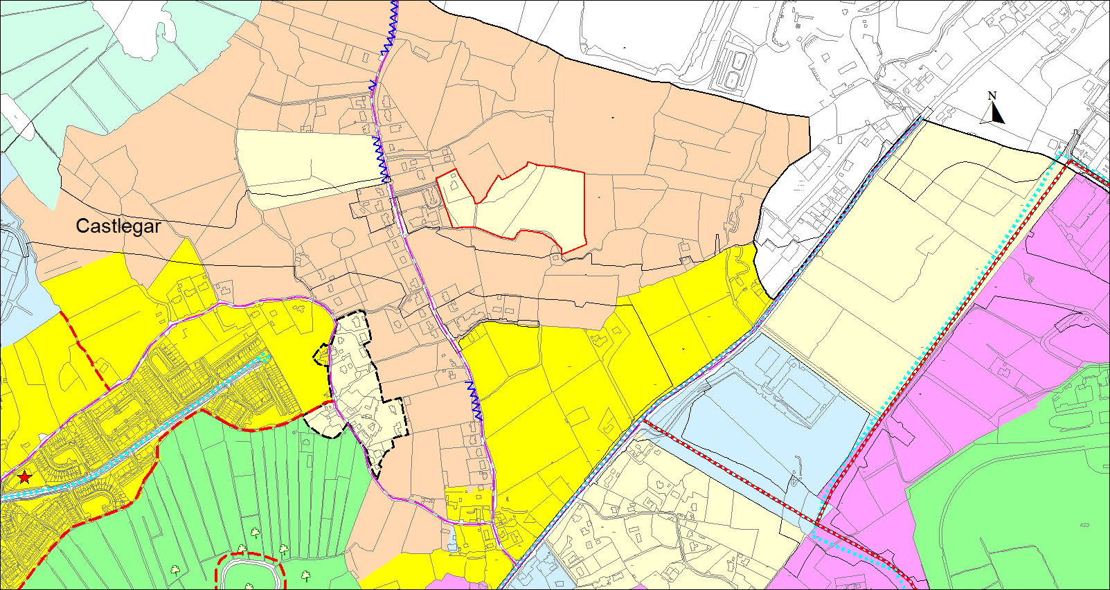
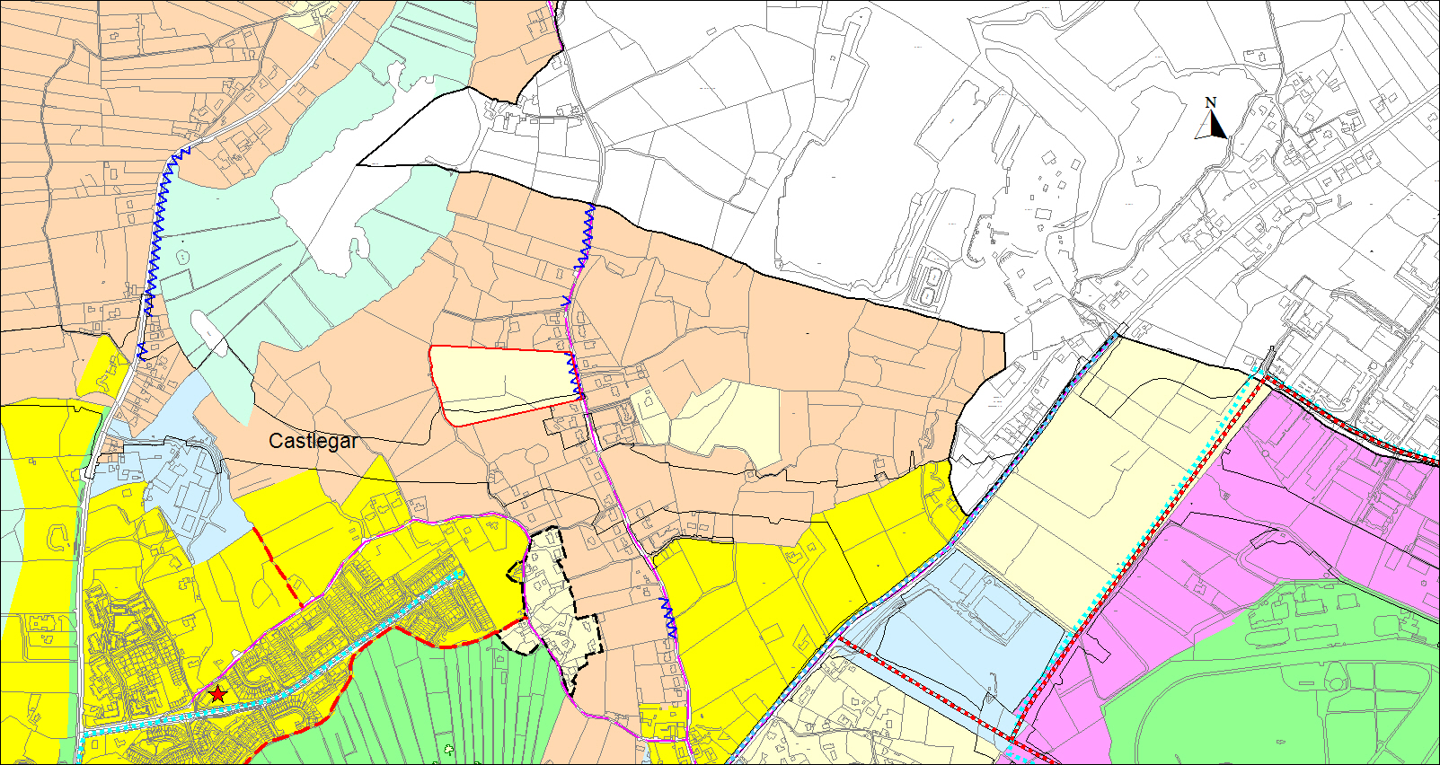
- R zoned lands south of the Dublin Road, Castlegar Hurling pitch. The strip of land adjoining the road boundary shall be reserved free from development and the existing trees be retained and additional trees planted along the road to ensure that the visual impact of any development is minimised.
- R zoned lands at Knocknacarra Road (Spinnaker House Hotel site). Any development including ancillary requirements will be designed so as not to impact the integrity of adjacent protected views. The Council will consider the adjoining RA zoned lands of approximately 0.086 hectares, associated with the existing use on the site to be used for the purposes of communal open space requirements associated with the redevelopment of the site for residential purposes, where it can be demonstrated that the entirety of this area will be restored to a natural, open environment and landscaped with native and biodiversity enhancing species. This RA land will not be permitted to be used for compliance with plot ratio standards nor used for car parking purposes. Credit will be given for existing floor space in the assessment of any future re-development.
-
R zoned lands at Ard Fraoigh (0.13 hectares). Any development on these lands shall be so designed to ensure preservation of the adjoining greenway and protection of the associated amenity therein.
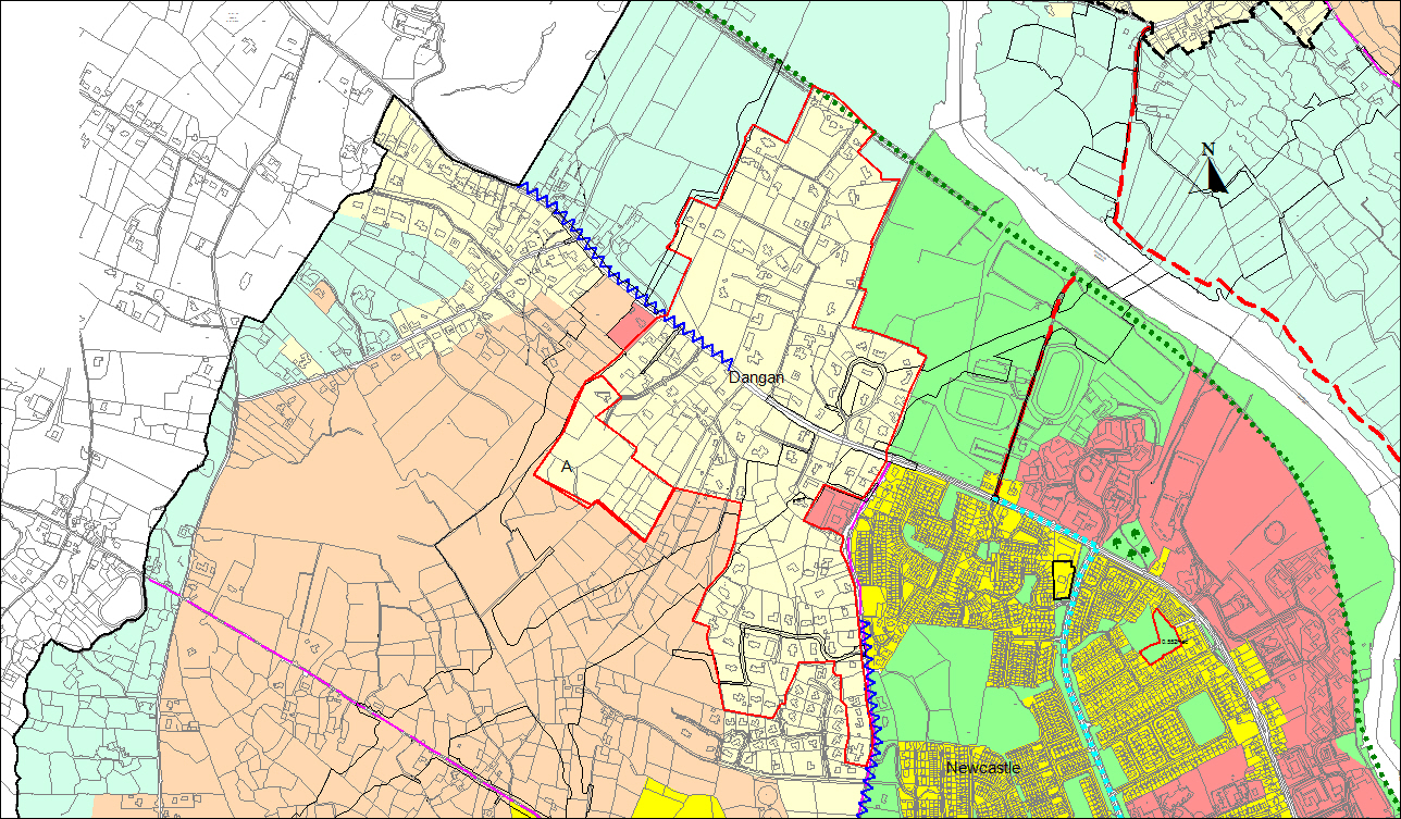
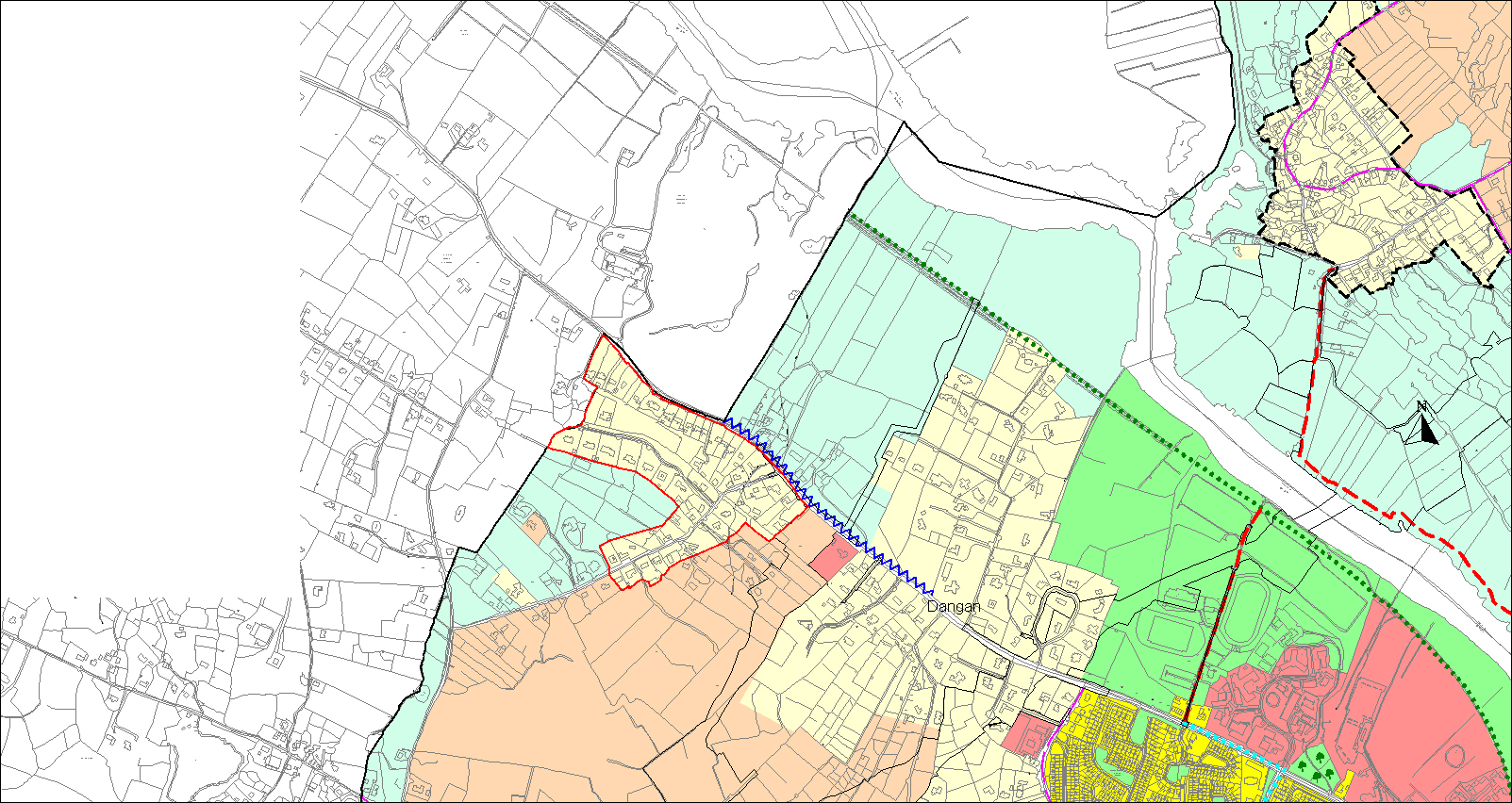
The following lands zoned R have the following specific development objectives, subject to design, environmental requirements and traffic safety. See associated maps:
|
|
|
|
|
|
|
|
|
|
|
|
|
|
|
Figure 11.7 Undeveloped residentially zoned land North West of Western Distributor Road |
|
|
|
|
|
|
|
|
|
The following are specific development objectives for a number of LDR zones throughout the city:
- LDR lands at Coolagh Road, opposite Crestwood. Development shall be limited to one house only.
- LDR lands at the junction of Gentian Hill. Development on these lands shall not exceed a density of 13 houses per hectare and shall be restricted to single storey dwellings.
- LDR lands comprising of approximately 0.47 hectares at Quarry Road, Menlo north of Menlo village end. Development shall be limited to one house only.
- LDR lands comprising of 4.68 hectares at Cappagh Road, Cappagh. Development of these lands shall generally have a maximum density of 2.5 houses to the hectare.
The following lands zoned LDR have the following specific development objectives, subject to design, environmental assessments, water and wastewater services and traffic safety. Communal open space and recreational facilities may be a requirement in certain circumstances:
|
|
|
|
|
|
|
|
|
|
|
|
|
|
|
|
|
|
|
|
|
|
|
|
|
|
|
|
|
|
|
|
|
|
|
|
|
|
|
|
|
|
|
|
|
|
|
|
|
|
|
|
|
|
|
|
|
|
|
|
|
|
|
|
|
|
|
Zoning Objective UVC To provide for a residential led mix of uses particularly those that will support a people and business friendly urban village centre and contribute to establishing a high quality sustainable urban form. |
|
|
Uses which are compatible with and contribute to the zoning objective: |
|
Contents
Observations
Observations
Submission relating to a Residential Zoning amendment in the Draft Galway City Council Development Plan 2023-2029 on a site located on Quarry Road, Menlo.
Please refer to attached document.
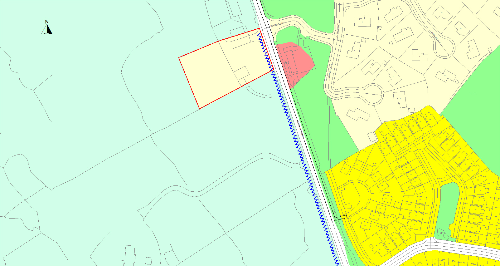
Submission relating to rezoning of land on the Barna Road, Galway City from Recreation and Amenity ‘RA’ to Residential ‘R’ and the inclusion of a new Policy Objective in the Draft Galway City Council Development Plan 2023-2029.
Please see attached document.